Photos: Take a Tour of Utah's Zion National Park
Uncommon area
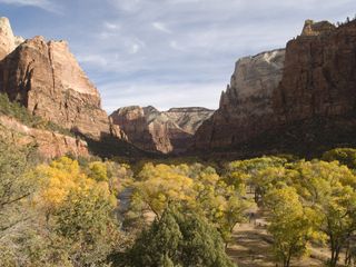
On the western edge of the Colorado Plateau is a most unique place known today as Zion National Park. The geological story of Zion began more that 250 million years ago, when this now spectacular area was covered by a shallow, inland sea. At that time, the area was relatively flat and the elevation was near sea level.
Mother Nature moves
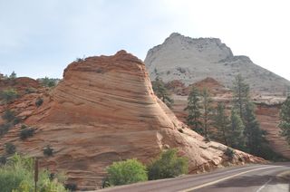
The forces of erosion began their work for thousands of years, bringing layers and layers of gravel, mud and sand to cover the Zion basin. The weight of these multiple layers of sediment caused the Zion basin to sink. Over the millennia, crustal forces caused the land to rise and fall as the environment alternated from shallow seas to coastal plains to vast areas of windblown sandy deserts.
An ancient story
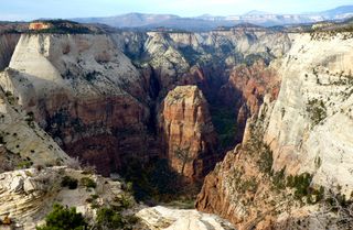
Zion is the geological story of an accumulation of a 10,000-foot-thick (3,050 meters) layer of sedimentation followed by regional uplifting of the land. The oldest rocks exposed at Zion are Permian Kaibab limestone, which just happens to be the top and youngest layer of rock exposed at the nearby Grand Canyon. Thus, where the geological story ends at the Grand Canyon, it begins anew in the spectacular cliffs and canyons of Zion.
Geographically unique

This whole geographical region displays a unique geological story of five spectacular cliffs rising northward from the Grand Canyon through Zion and continuing north into the Bryce Canyon area. The region is known as the Grand Staircase. When viewing the whole Grand Staircase region, a spectacular 2-billion-year geological history of the Earth is exposed.
Layers of history
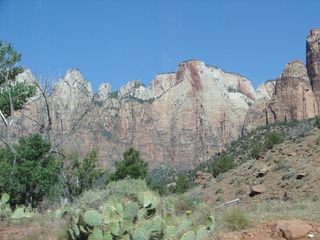
The water that fell and flowed upon the Zion basin filtered down through the thick sediments. It contained common cementing agents like silica, calcium carbonate and iron oxide that resulted in the ancient seabeds turning into mudstone, shale, limestone and sandstone. The many layers of sediment all had distinct characteristics of color and varying minerals resulting in the varied and unique landscape seen today.
Natural erosion
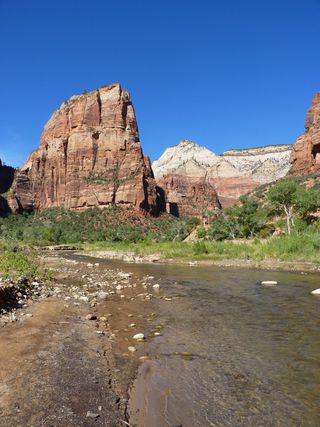
When the whole Colorado Plateau began to rise some 20 million years ago during the Miocene Epoch, the Zion basin rose in elevation from near sea level upward to nearly 10,000 feet (3,050 m). Ancient rivers immediately began flowing down, beginning the erosion of the land into the deep and narrow canyons found at Zion today. Today, the Virgin River is still carrying on the never-ending process of carving and carrying away the sedimentary rocks of Zion.
Change is the norm
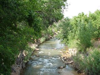
Geologists suggest that the North Fork of the Virgin River that flows through a part of Zion moves almost 5,000 tons of rock fragments every day. Flash floods that crash through the canyons after a summer thunderstorm cause most of the erosion. Such a flash flood can send some 9,000 cubic feet (255 cubic meters) of water per second raging down the Zion Canyon. Geologists further estimate that these flash floods are resulting in the floor of Zion Canyon lowering at a rate of 600 feet (183 m) per million years.
Sign up for the Live Science daily newsletter now
Get the world’s most fascinating discoveries delivered straight to your inbox.
Paradise found
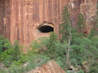
Zion National Park was established on Nov. 19,1919, to protect this 229-square-mile (590 square kilometers) geological and natural paradise. It was the first national park established in Utah and is revered by visitors for its slot canyons, monoliths, natural arches, rivers and waterfalls. The desire of visitors to experience the grandeur of Zion led to the building between 1927 and 1930 of the Zion-Mt. Carmel Highway, which follows the profile of Pine Creek Canyon and features a 1.1-mile-long (1.8 km) tunnel blasted and bored through the mountain of thick Navajo sandstone. Aseries of "gallery windows" were blasted through the cliff face, creating a source of natural light, ventilation and spectacular views.
Variety in abundance
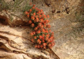
The elevations of Zion vary from near 4,000 feet (1,200 m) above sea level on the Uinkaret Plateau to almost 10,000 feet (3,050 m) at the summit of the Markagunt Plateau. Such diverse elevations bring about varying amounts of sunlight, rainfall and temperature ranges and result in a wide variety of plant life covering the land. More than 900 species of plants are indigenous to Zion. Species native to riparian and aquatic habitats, arid grassland and desert shrub can be found on the park grounds. At the higher elevations, vast forests of pinyon-juniper, ponderosa pine, mixed-conifer and aspen can all be found. The Eastwood Indian Paintbrush, shown here, flourishes in the cracks of the canyon walls of Zion.
Diversity abounds
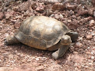
The wide range of habitats found within Zion leads to a great diversity and abundance of animal life. Since Zion is located at the meeting point of the Colorado Plateau, Great Basin and Mojave Deserts, physio-geographic zones, animals from all those regions are commonly found here. More than 78 species of mammals, 291 species of birds, 44 species of reptiles and amphibians as well as 8 species of fish are found at Zion. A desert tortoise, Gopherus agassizii, shown here, slowly moves through an arid region of Zion.
Checkboard geology
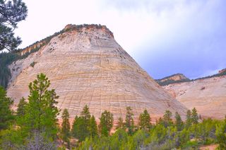
The unique geology of Zion is no better illustrated than with the cliffs of checkerboard sandstone located in the eastern area of the national park. The horizontal lines seen here were created in the sandstone during the Jurassic period by blowing sands from the massive ancient dunes. Further weathering from thousands of years of freezing and thawing hasresulted in creating the vertical lines.
Most Popular

